Orissa Map District Click here to View & Download Odisha map Odisha Map – You can download the map of Odisha as a PDF for free. You can use this map for educational and non-commercial purposes. Odisha (Orissa) is one of the 29 states of India. The state is locatedRead More →

Punjab Map District Punjab Map Download the free map of Punjab in pdf form. You can use this map for educational and noncommercial purposes. View & Download Punjab Map  About Punjab Located in the northwest corner of the country, Punjab is bounded by Pakistan in the west, Jammu & KashmirRead More →

Madhya Pradesh Map District Click to View & Download Madhya Pradesh Map  Madhya Pradesh map You can download the map of Madhya Pradesh as a PDF for free. You can use this map for educational and non-commercial purposes. This Madhya Pradesh map is not to scale. Madhya Pradesh is locatedRead More →

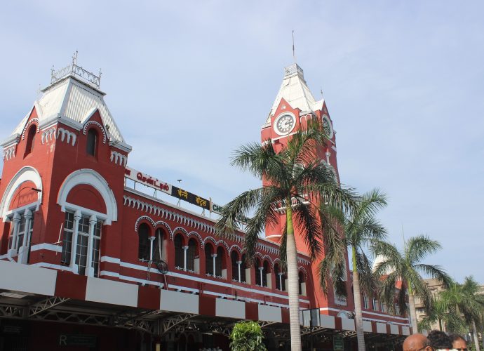
chennai

Chennai is the capital of Tamil Nadu and it is the fourth largest city in India. Madras was the old name of this metropolitan city until 1996 from the period of the British raj. It is located near the state of Andhra Pradesh on the northeastern tip of Tamil Nadu.Read More →

Rajasthan Map You can view and download Rajasthan Map for free pdf. It can use educational and noncommercial purposes. These maps are not to scale. Rajasthan  Map-Districts View/Download Map   Rajasthan Road Map View/Download Map Rajasthan Admi. Map View/Download Map  Outline Map View/Download Map Rajasthan is situated in the northwestRead More →

Gujarat Map Gujarat India is the most industrialized state in the country. Gujarat is situated on the west side of India, bounded by the Arabian Sea to the west, Pakistan to the north, Rajasthan to the north and northeast, Madhya Pradesh to the east and the central states of Daman andRead More →

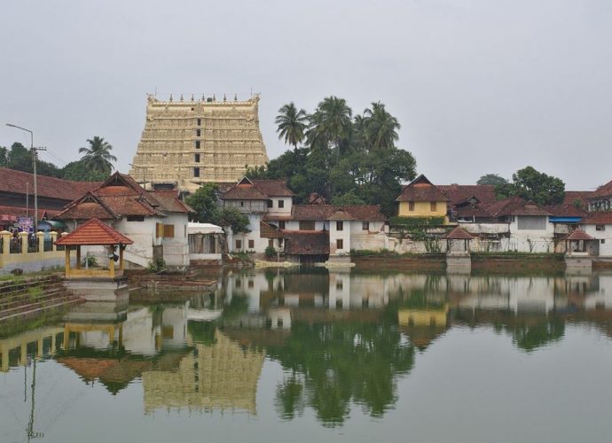
thiruvananthapuram

Kerala Capital Thiruvananthapuram, also called Trivandrum, is one of the oldest state capitals in India. The name Thiruvananthapuram came from the Malayalam word Thiru-Anantha-Puram, meaning the “City of Lord Ananta”. It originates from the Sri Padmanabhaswamy Temple in the heart of the city. About Thiruvananthapuram, the Kerala Capital In theRead More →

Karnataka Map-Karnataka state is located in the southwestern region of India. It borders Maharashtra state to the North, Telangana to the North East, Andhra Pradesh to the East, Tamil Nadu to the Southeast, Kerala to the south, the Arabian Sea to the west and Goa to the Northwest. The totalRead More →

Karnataka Districts Map Click Here To Download Karnataka Districts Map Karnataka Districts Karnataka has divided into 30 districts under 4 administrative divisions. The state Karnataka geographically has three main regions. They are Karavali, the coastal region, Malenadu the hilly region of the Western Ghats and Bayaluseeme comprising the plains ofRead More →

Kerala Map Kerala is situated at the end of the southwest coast of the Indian subcontinent. Kerala shares its boundaries with Tamilnadu in the South and East and Karnataka in the North and East. The Western side of the state is totally covered with the Arabian Sea. Kerala Political MapRead More →