Jharkhand Map – Download the map of Jharkhand free of cost. You can use this map for educational and noncommercial purposes.
Jharkhand is one of the 28 states in India. It is situated in the central-east of the country. Jharkhand is the 15th largest state by area in India. The total land area of Jharkhand is 79,710 km2 (30,778 sq m). Jharkhand state is bordered with the states of Bihar in the north, Uttar Pradesh in the northwest, Chhattisgarh in the west, West Bengal in the east and Odisha in the south.
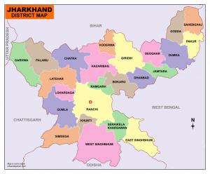
Ranchi is the capital of Jharkhand. Jharkhand is divided into 24 districts under 5 divisions.
Jharkhand Map
Click Here to view &Download Jharkhand Map District
Divisions are
Palamu, North Chotanagpur, South Chotanagpur, Kolhan, and Santhal Pargana.
The Districts are
|
Garhwa Palamu Latehar Chatra Hazaribag Giridih Koderma Dhanbad Bokaro Ramgarh Ranchi Lohardaga |
Gumla Simdega Khunti West Singhbhum Seraikela Kharsawan East Singhbhum Deoghar Jamtara Dumka Godda Pakur Sahebganj |
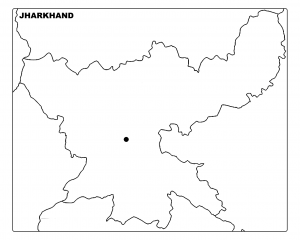
Click Here to View & Download Jharkhand Map Outline
1 Comment