Maharashtra Map
About Maharashtra
Maharashtra is India’s third-largest state by area spread over 307,713 km2 (118,809 sq mi). It is surrounded by the Arabian Sea to the west, the Indian states of Karnataka and Goa to the south, Telangana to the southeast and Chhattisgarh to the east, Madhya Pradesh and Gujarat to the north, and the Indian union territory of Dadra and Nagar Haveli to the northwest. Maharashtra is one of the most industrially and commercially developed states of India.
Maharashtra was formed by merging the western and south-western parts of the Bombay State, Berar and Vidarbha, and the north-western parts of the Hyderabad State and splitting Saurashtra (in present-day Gujarat) by the State Reorganisation Act. Mumbai is the capital and Marathi is the official language of Maharashtra.
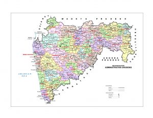
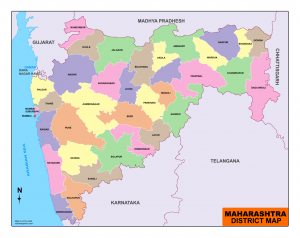
Maharashtra is divided into 36 districts under 6 administrative divisions
| Ahmadnagar | Gadchiroli | Nagpur | Ratnagiri |
| Akola | Gondia | Nanded | Sangli |
| Amravati | Hingoli | Nandurbar | Satara |
| Aurangabad | Jalgaon | Nashik | Sindhudurg |
| Beed | Jalna | Osmanabad | Solapur |
| Bhandara | Kolhapur | Palghar | Thane |
| Buldhana | Latur | Parbhani | Wardha |
| Chandrapur | Mumbai City | Pune | Washim |
| Dhule | Mumbai Suburban | Raigad | Yavatmal |

Download Maharashtra map Administration
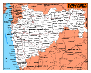
Maharashtra map – city

Mumbai, Pune, Nagpur, Thane, Nashik, Aurangabad, Kolhapur, Amaravati, Kolhapur, Ratnagiri are the important cities in Maharastra
Maharashtra tourist places
Maharashtra displays a fascinating variety of brilliant achievements that can be seen in its cave temples and Hindu shrines. Massive forts and historical battle sites all tell the story of Marathas. Maharashtra, gifted with enormous natural beauty that is quiet and beautiful hill stations palm-shaded Golden beaches placid lakes, a warm spring variety of wildlife and more.
Ajanta, Amaravati, Mumbai, Aurangabad, Solapur, Vjresswari, Pune, Lonawala, Nagpur, Nashik,……
Maharashtra Map Outline


5 Comments