Click Here to Full View or Download This UK Map Countries
![]()
Download UK Map Blank
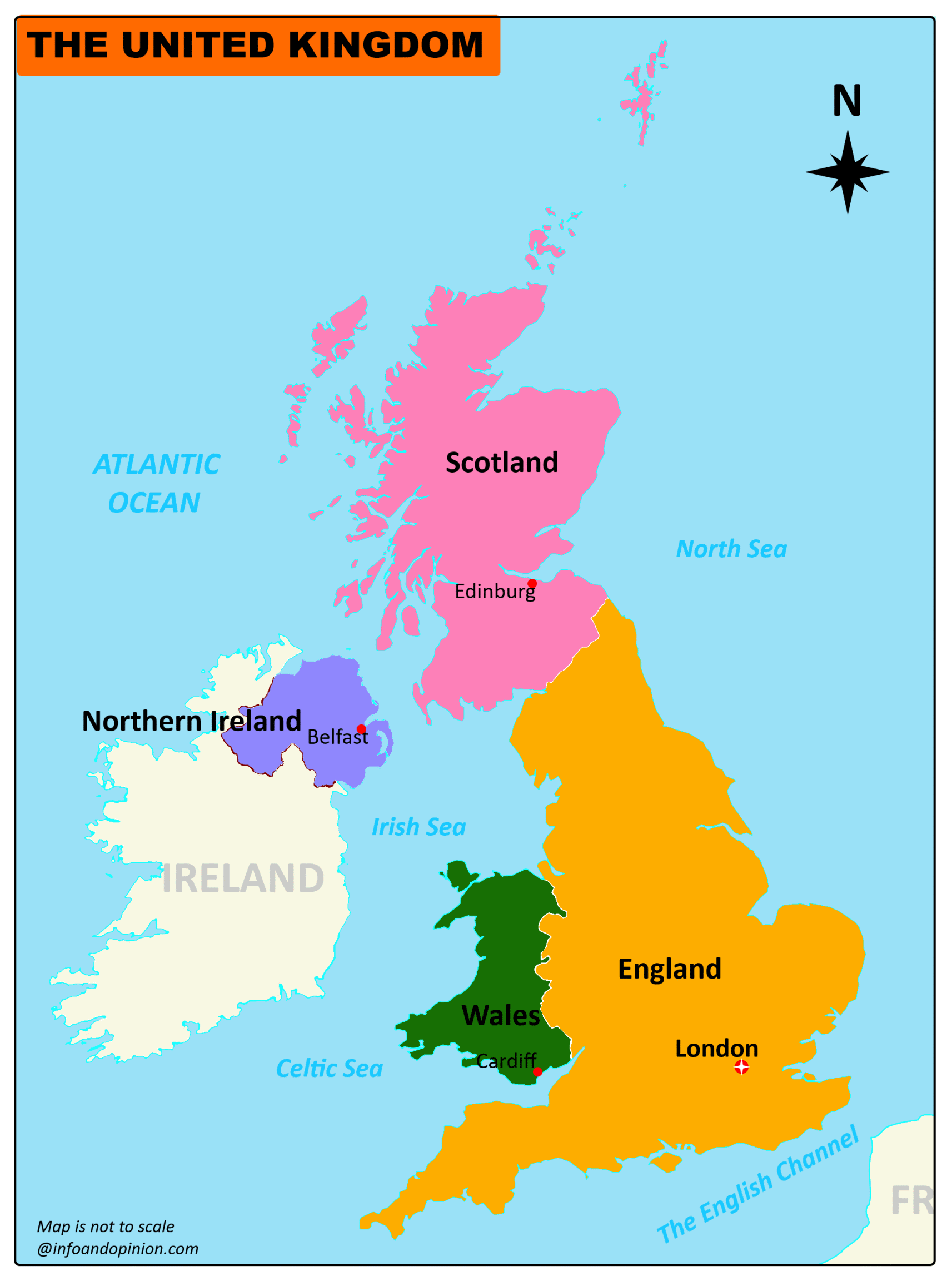
Here you can see and download the UK map with 4 Nations and their capitals for free. You can use this pdf map for educational and noncommercial purposes.
The United Kingdom (UK) or Great Britain is located on the northwestern coast of mainland Europe. This island country includes four nations namely England, Wales, and Scotland, and the northern part of the island of Ireland and many small islands Its only land border of Northern Ireland was shared with the Republic of Ireland. The total area of the United Kingdom is 242,500 square kilometers.
The United Kingdom (Northern Ireland) shares its coastline of the Atlantic Ocean with the Republic of Ireland. The North Sea to the east, the English Channel to the south, and the Celtic Sea to the south-west, The Irish Sea divides Great Britain and Ireland as two separate islands. London is the capital of Great Britain, it is one of the world’s major commercial, financial and cultural centers. Other major cities are Birmingham, Liverpool, and Manchester in Belfast and Londonderry in Northern Ireland, Edinburgh in Scotland and Glasgow in Scotland, and Swansea and Cardiff in Wales.
⊕All maps provided on this website are for educational purposes only and to give the visitors a rough idea of the geographical location of the places. Therefore, we do not claim that it contains completely accurate information.