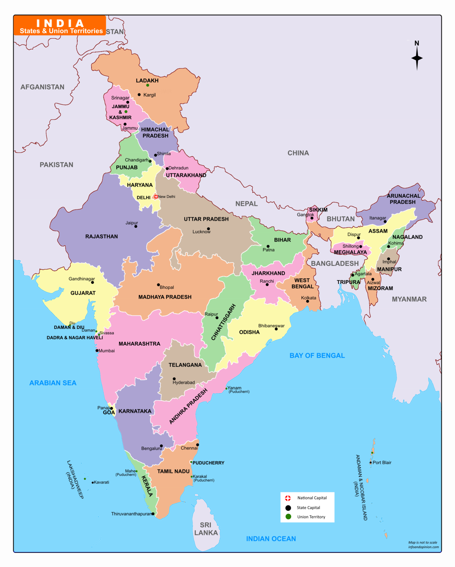
Download India Political Map-2019
Name of the States:
Andhra Pradesh, Arunachal Pradesh, Assam, Bihar, Chhattisgarh, Goa, Gujarat, Haryana, Himachal Pradesh, Jharkhand, Karnataka, Kerala, Madhya Pradesh, Maharashtra, Manipur, Meghalaya, Mizoram, Nagaland, Odisha, Punjab, Rajasthan, Sikkim, Tamil Nadu, Telangana, Tripura, Uttar Pradesh, Uttarakhand, and West Bengal
Names of Union Territories:
Andaman & Nicobar Islands, Chandigarh, Dadra & Nagar Haveli, Daman & Diu, Lakshadweep, Puducherry, Delhi (NCT – National Capital Territory), Jammu & Kashmir, Ladakh
Download the List of Indian States and Capitals
Give us a like if our effort seems useful to you!
1 Comment