Districts in Assam

How Many Districts in Assam?

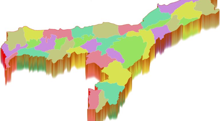
The State of Assam is divided into 33 Administrative Districts under five regional divisions. Karbi Anglong is the largest district of Assam with nearly 10,434 square kilometres of undivided area, and the South Salmara-Mankachar District is the smallest with an area of 568 square kilometres. Majuli District carved out of the Northern parts of Jorhat District is the first river island district of India.

List of Districts in Assam with Divisions

Division Name

Districts

Barak Valley

Cachar, Hailakandi, and Karimganj


Central Assam


0.00

Lower Assam


0.00

North Assam

0.00

Upper Assam

Charaideo, Dhemaji, Dibrugarh, Golaghat, Jorhat, Lakhimpur, Majuli Sivasagar, and Tinsukia


Click here to Download the List of Districts in Assam in Pdf
List of District in Assam with Website

Code

District

Headquarter

Area (km²)

Population (2011)

Website

1 BK Baksa Mushalpur 2,400 953,773 http://baksa.gov.in/
2 BP Barpeta Barpeta 3,245 1,693,190 https://barpeta.assam.gov.in/
3 BS Biswanath Biswanath Chariali 1,100 5,80,000 https://biswanath.gov.in/
4 BO Bongaigaon Bongaigaon 1,724 2,060,550 https://bongaigaon.gov.in/
5 CA Cachar Silchar 3,786 1,736,319 https://cachar.gov.in/
6 CD Charaideo Sonari https://charaideo.gov.in/
7 CH Chirang Kajalgaon 1,468 481,818 https://chirang.gov.in/
8 DR Darrang Mangaldai 1,585 908,090 http://darrang.nic.in/
9 DM Dhemaji Dhemaji 3,237 688,077 https://dhemaji.gov.in/
10 DU Dhubri Dhubri 2,838 1,948,632 https://dhubri.gov.in/
11 DI Dibrugarh Dibrugarh 3,381 1,327,748 https://dibrugarh.gov.in/
12 DH Dima Hasao Haflong 4,888 214,102 http://www.diprnchills.gov.in/
13 GP Goalpara Goalpara 1,824 1,008,959 http://goalpara.gov.in/
14 GG Golaghat Golaghat 3,502 1,058,674 https://golaghat.gov.in/
15 HA Hailakandi Hailakandi 1,327 659,260 https://hailakandi.gov.in/
16 HJ Hojai Hojai 931,218 https://hojai.assam.gov.in/
17 JO Jorhat Jorhat 2,851 1,091,295 http://jorhat.gov.in/
18 KM Kamrup Metropolitan Guwahati 1,528 1,260,419 http://kamrupmetro.in/
19 KU Kamrup Amingaon 1,527.84 1,517,202 http://kamrup.nic.in/
20 KG Karbi Anglong Diphu 10,434 965,280 https://karbianglong.gov.in/
21 KR Karimganj Karimganj 1,809 1,217,002 https://karimganj.gov.in/
22 KJ Kokrajhar Kokrajhar 3,129 930,404 http://kokrajhar.gov.in/
23 LA Lakhimpur North Lakhimpur 2,277 1,040,644 http://lakhimpur.nic.in/
24 MJ Majuli Garamur 880 167,304 https://majuli.gov.in/
25 MA Morigaon Morigaon 1,704 957,853 https://morigaon.gov.in/
26 NN Nagaon Nagaon 2,287 1,892,550 https://nagaon.gov.in/
27 NB Nalbari Nalbari 2,257 769,919 https://nalbari.gov.in/
28 SV Sivasagar Sivasagar 2,668 1,150,253 http://sivasagar.nic.in/
29 ST Sonitpur Tezpur 5,324 1,925,975 https://sonitpur.gov.in/
30 SM South Salmara-Mankachar Hatsingimari 568 555,114
31 TI Tinsukia Tinsukia 3,790 1,316,948 http://tinsukia.gov.in/
32 UD Udalguri Udalguri 1,676 832,769 http://udalguri.gov.in/
33 WK West Karbi Anglong Hamren 3,035 3,00,320

Download Assam District Map


1 Comment

Leave a Reply

Your email address will not be published. Required fields are marked *